Links
and More
Home
My Eagle
My Links
My News
My Patches
My Photos
My Troops
My Trips
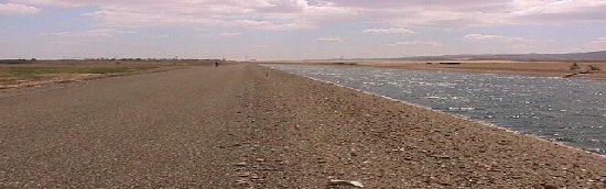
The following are maps of the checkpoints that we used on the California Aqueduct trip. Next to each map are directions to each checkpoint and the approximate mileage between points.
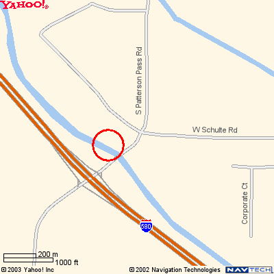 |
Checkpoint 1 will be approximately 5 to 6 miles into the trip. The Street name is South Patterson Pass Road. The nearest cross street is W Schulte Road. The easiest way to get here is probably to head back out on Grant Line Road. S. Patterson is a cross street to Grant Line. From Grant Line you will turn right and head south on South Patterson Pass Road. If you hit 580 you've gone too far. Remember there are two canals. |
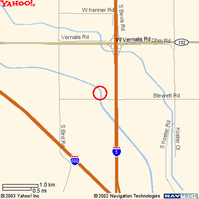 |
Checkpoint 2 will be approximately 13 miles from the 1st Checkpoint. The Street name is Blewett Road. The nearest cross street is S. Bird Road. Neither of these streets have off ramps from the Freeway. The easiest way to get here is probably to head South on 580. Take the 132 Exit for W Vernalis Road. Then take a right on S. Bird, then a left on Blewett Road. |
| NOTE: From here you need to follow Blewett Road up and over I-5. At the bottom of the overpass is a paved road just to the right, it will take you back to the Aqueduct. If you following the Aqueduct without going over the overpass you will not be able to get under I-5. | |
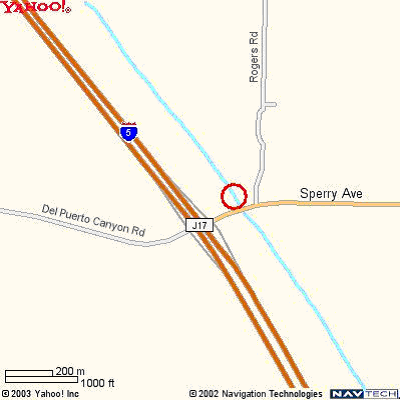 |
Checkpoint 3 will be approximately 13 miles from the 2nd Checkpoint. The Street name is Sperry Ave. The nearest cross street Rogers Road. You should be able to head South on I-5 and take the Sperry Ave Exit. On the map it shows as Exit J17. It might also be called the Del Puerto Canyon Road Exit. Once you get off the exit you will go up and over the freeway and then it will be just on the other side. |
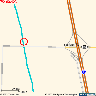 |
Checkpoint 4 will be approximately 14 miles from the 3rd Checkpoint. The Street name is Sullivan Road. The nearest cross street is I-5. The Exit is the Gustine 140 Road Exit. When you get off at the ext you will turn right and continue down the road. Again the the canal will be on the west side of the freeway. |
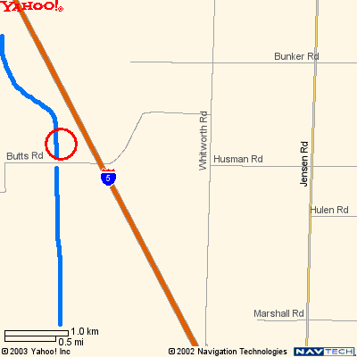 |
Checkpoint 5 will be approximately 7 miles from the 4th Checkpoint. The Street name is Butts Road. The nearest cross street is Whitworth Road. From Check point 4 head east on Sullivan back up and over the freeway. When you get to Whitworth Road turn right. When you get to Butts Road turn right. You will go up and over the freeway. You will then get to the canal. Again the the canal will be on the west side of the freeway. |
My Scout Page | Index | Journal | Photo Gallery | Checkpoints
![]()
Copyright © 2003 Devin Holmes